 Turnertoys Home Page: "Good Things for Kids"
|
ED'S OUTDOOR PAGES (fomerly the official website of the Green Mountain Club Montpelier Section) |
Turnertoys Home Page: "Good Things for Kids"
Snowshoeing in January at 50 below (wind-chill, that is)
Hiking up the Long Trail to the Chin (Summit) of Mt Mansfield
Vermont's highest peak
[Large Page - 36 sec @ 28k - be patient]
|
January 25, 2004 |
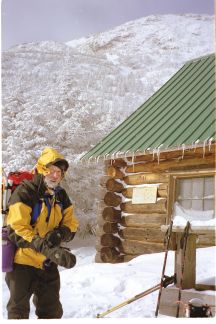 Ed L. stopping for lunch at Taft Lodge. Summit is out of sight at upper right, about 200 ft higher than visible ridge line. More photos below. |
|
It was a cozy -5 F inside the lodge as we stopped to have a quick lunch and pile on the layers for the climb. John's and Jay's water had frozen on the way up, but both my water bottle in its insulated carrier and my thermos of tea were still useful. John and Jay took turns breaking trail in the 12" - 18" powder up to the base of the chin. There was enough packed snow cover to make climbing on ice or rock unnecessary, so the way up and down was relatively safe and uneventful. As we reached the top, the full force of the prevailing Northwest wind hit us. I estimate it was 30-50 mph, gusting as high as 70. At the summit it was -13� Farenheit, with a 50 mph wind gusting to an estimated 65 or 70. From my experience with accurately measured wind speeds on New Hampshire's Mt Washington, I know that if I have to momentarily stop walking and crouch for a second to keep from being blown off balance, it is about 70 mph. Paul measured the temperature at -13 F. This yields a windchill value of -50� F. The view was great, but we didn't stay long. Despite goggles and face mask, I felt the few exposed inches on my face starting to freeze. Sorry - no photos at the summit. The conditions were not really suitable for removing mittens. We still had enough sun on the descent to
make the day seem warm and cozy; Paul's pack thermometer actually read
+10 F in a sunny area! We stopped briefly outside Taft for a snack and
clothing adjustment, and again bushwacking the traverse, found the Long
Trail and reached the trailhead by a little after 3:00. For this group
of experienced and well-equipped hikers, the day had been perfect in
every respect. |
|
|
The Block Shoppe Trains Woodkins Rattles & tops, Old-Fashion Wood Toys Toy Finder Airplanes Toddler Play Structures |
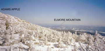
Taken from the broad gulley between the Chin and Adams
Apple. Elmore Mt is visible East Northeast of Mansfield, about 20 miles away. |
|
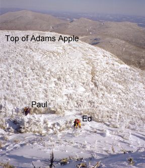
| Half-way up the Chin to the summit. It is hard to do justice in a photo to how steep this really is. View is toward the East. |
|
|
|
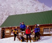
Ed, John, Jay, Paul at Taft Lodge
Larger image |
|
| Comments and questions? Email them to ed@turnertoys.com |
 Turnertoys Home Page: "Good Things for
Kids"The Toys we grew up with
Turnertoys Home Page: "Good Things for
Kids"The Toys we grew up with
[an error occurred while processing this directive]