 Turnertoys Home Page: "Good Things for
Kids"
Turnertoys Home Page: "Good Things for
Kids"|
ED'S OUTDOOR PAGES and list of Trip
Reports September 24, 2005 Mt. Eisenhower and Monroe: Edmands path to Eisenhower Summit; Crawford Path to Monroe Summit. 8.8 miles White Mountain Presidential Range, NH |
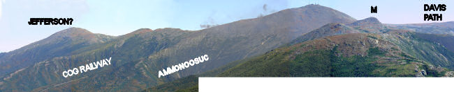 |
| Mount Washington and its surroundings This image is a composite of photos taken from the summit of Eisenhower. The infamous coal-burning "Smog Railway" originates at the bottom of Ammonoosuc Ravine. We took the steep, wet Ravine trail going down. Mt Jefferson is seen at left, north of Washington, with its antennae seen on the summit. A train leaves a trail of smoke near the top. The view is straight along the Crawford path (at right), past an unnamed small summit, to Monroe, with Washington in the background. Davis Path leads along a ridge from Washington to Boot Spur, then south to Mts Isolation & Davis. See larger versions of this photo: 488 kb 3.211 mb / 131 sec @ 28k (recommended for broadband only) |
| Paul and Charles in the col approaching the Eisenhower summit trail. We decided that Eisenhower is a pleasant and "inoffensive" summit. The views were excellent on this dry, cool, clear day: the best weather of the summer. | 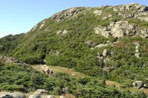 |
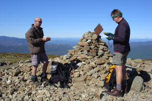
| At the summit, Mt
Eisenhower. Paul and Charles check maps and GPS. Vermont's Green
Mountains are visible in the distance. Great visibility!
"OK - where the hell are we?" |
 |
| View to the Southwest from Eisenhower. The ridge in the distance is probably Franconia, about 18 miles away, with Lincoln (1) and Lafayette (2). 3 and 4 are likely South & North Twin, about half the distance. The near peak (5) may be Mt Avalon, possibly Mt Field. | 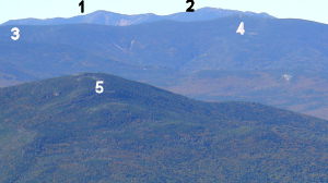 |
| The Green Mountains are just visible in the distance. (Actually, this is less clear in the photo than it was to the eye.) Camel's Hump and Mt Mansfield are marked. | 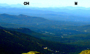 |
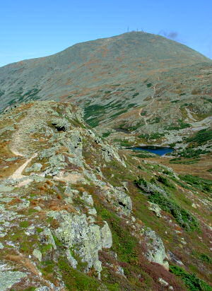
| Eisenhower sits above a lovely
green col with a small pond, and just beyond can be seen a crossroads of
trails, with Crawford Path, part of the Appalachian Trail, heading south
to the right. We took Crawford north to Monroe.
Paul descending from Eisenhower |
 |
| Looking along the The Crawford Path ridge to Monroe (cone-shaped summit on right). The small mound at left is apparently nameless, and was not even indicated as an elevation on our topo maps. We did claim a small cairn on it for the Montpelier section of the GMC, and named it Mount Bush. | 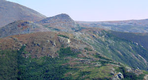 |
| Charles, Paul, and Ed on Mt Monroe summit. Mt Washington is in background. | 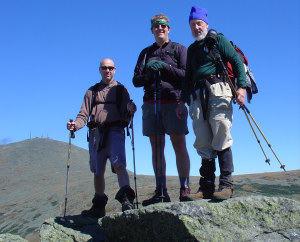 |
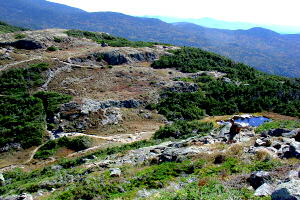
| The trail to Lake of the Clouds
proceeds along the ridge at left and descends steeply into the col between
Monroe & Washington. We had lunch in the warm sun outside the
hut.
|
 |
| Oakes Gulf and the Dry River Trail descends from Lake of the Clouds Hut into the Dry River Wilderness. At top is the Davis Path Ridge, Boott Spur, and Davis Path proceeding south above Oakes Gulf. | 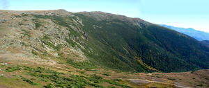 |
| Just off the Ammonoosuc Trail is this large (at least 100 ft high) waterfall) | 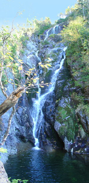 |
| Your reporter, Ed Loewenton | 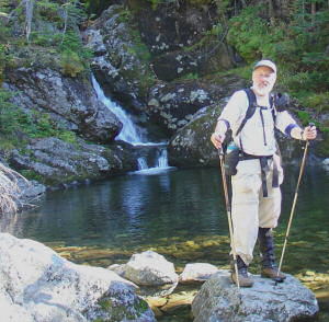 |
ED'S OUTDOOR PAGES and list of Trip Reports